
The Warren and Youngstown Winter Guide for Driveways, Walks and Yards
How much snow the Valley really gets, when it shows up, and what to do about your driveway, walks, lawn and lot before the first storm.
Published November 12, 2026 by the Phillips Care Landscaping crew, Warren, OH. More guides
Phillips Care Landscaping · Warren, OH
Youngstown snowfall averages 67.8 inches a season at Youngstown-Warren Regional Airport, the official station for Warren and Youngstown. Snow usually starts in early November, piles up fastest in January, and keeps coming into early April. That means about five months of plowing, shoveling and salting, so the time to get ready is before the first storm.
Key Takeaways
- NOAA's 1991 to 2020 normals put January, the snowiest month, at 19.6 inches.
- Our count of NOAA daily records shows a typical first measurable snow around November 7.
- The ground holds an inch or more of snow about 58 days a winter.
- Plow, then clear walks, then salt. Rock salt slows down below about 15 degrees pavement temperature.
This guide pulls the local numbers into one place and turns them into a plan for your driveway, walks, lawn and parking lot. It's written from the plow seat. We're a Warren crew that plows driveways and lots across Trumbull and Mahoning County, and we mow and clean up those same yards the rest of the year. If you already know you want help, see our driveway snow plowing service.
What does Youngstown snowfall look like in a normal winter?
About 68 inches in an average season. NOAA's 1991 to 2020 climate normals for Youngstown-Warren Regional Airport in Vienna Township, pulled from the NOAA ACIS normals data, add up to 67.8 inches. Almost all of it falls from November through March, with January the clear peak.
| Month | Normal snowfall (inches) | Avg days with 1 inch or more on the ground |
|---|---|---|
| October | 0.7 | 0.1 |
| November | 4.5 | 2.2 |
| December | 14.8 | 11.6 |
| January | 19.6 | 19.3 |
| February | 15.1 | 15.9 |
| March | 10.5 | 7.9 |
| April | 2.6 | 0.9 |
The Youngstown snowfall column comes from NOAA's 1991 to 2020 normals. The snow-on-the-ground column is our own count of NOAA daily records for the same station, using the 27 winters from 1990 to 2020 with complete data. Your street may run a little higher or lower, but these are the official numbers for the Valley.
Totals swing a lot from one winter to the next. In the NOAA daily records, the snowiest season was 2010 to 2011 at 118.7 inches, with 53.1 inches in December 2010 alone. The lightest was 1990 to 1991 at 30.6 inches.
Big single storms are less common than people think. NOAA daily records show the airport averaged about 22 days a winter with an inch or more of new snow, but only about one day a winter with 6 inches or more. The biggest one-day total was 14.7 inches on March 13, 1993.
When does snow season start and peak in the Valley?
It starts in early November and peaks in January. In our count of NOAA daily records from 27 complete winters, the median first measurable snow fell on November 7 and the median last one on April 7. The earliest first snow in that span came on October 2, so October flakes do happen.
January stands out on every measure. It has the most snowfall, 19.6 inches on average, and the most days with snow on the ground, about 19 of its 31. February is close behind. By March, sun and warmer days melt snow faster, even though March still averages over 10 inches.
The cold matters as much as the snow. NOAA daily records for the airport show about 30 nights a winter with an air temperature of 15 degrees or colder. Pavement runs a few degrees warmer or colder than the air, but that's the range where rock salt slows way down, which is why ice that sits on a walk in January can be so stubborn. More on that in the salt section below.
Does lake effect snow reach Trumbull and Mahoning County?
Sometimes, but the heaviest bands usually stay north of us. The National Weather Service explains in its lake effect snow guide that cold air crossing the warmer Great Lakes forms narrow bands that can drop 2 to 3 inches an hour, while sun shines a mile or two away.
The late 2024 storm shows how narrow those bands can be. In its event summary for the Thanksgiving 2024 lake effect storm, NWS Cleveland listed spotter totals of 30 to 40 inches in parts of Ashtabula County. Over the same days, spotters reported 2.7 inches in Cortland, 1.2 near Newton Falls, 0.9 near Austintown and 0.7 in Canfield.
So most of the Valley's snow comes from regular winter storms, with lake effect bands reaching us when the wind lines up. Even in that storm, the Trumbull County reports ran higher than the Mahoning County ones. Either way, a plow plan should be built for the 68-inch season, not the lucky winters.
Getting your driveway and walks ready before the first storm
Do the prep while the ground is still soft, ideally in late October or early November. In NOAA daily records for the airport, the first hard freeze of 28 degrees typically came around October 31. After that, stakes go in harder and anything left in the yard freezes in place.
- Stake both edges of the driveway with tall reflective markers so the edges show under deep snow.
- Mark the things a plow can't see: low curbs, drains, the end of the walk and the corners of beds.
- Pick a spot for the snow pile that isn't a shrub bed and doesn't block your view of the street.
- Clear leaves off the lawn so they don't sit under snow all winter. Our post on whether to mulch or bag your leaves covers how.
- Put hoses, decorations and garden edging away from the driveway edge.
- Plan to park in the garage or off to one side on storm nights.
Most plow damage we see in spring traces back to one of those items. An unmarked curb or bed corner is invisible at night under 8 inches of snow.
Salt, ice melt or sand: what keeps walks safe?
Clear the snow first, then use a little salt only where ice is left. The University of Minnesota's Local Technical Assistance Program, in its Winter Salt Guide for homeowners, says rock salt works down to about 15 degrees of pavement temperature. Below that it works very slowly, and sand is the better choice for traction.
| Material | Works best | Trade-off |
|---|---|---|
| Rock salt (sodium chloride) | Pavement at about 15°F and warmer | Cheapest; slow in deep cold; hard on lawns and plants |
| Calcium or magnesium chloride blends | Colder days; calcium chloride works down to about -20°F | Costs more; still a chloride |
| Sand or grit | Any temperature | Adds traction only; never melts ice |
Less salt goes further than most people think. The University of Minnesota guide says to remove snow first and skip salting while it is still snowing, since that salt just gets plowed or shoveled away. Its when and where to apply salt page also says to spot treat icy patches instead of salting a whole cleared surface. Salt on bare, dry pavement mostly ends up in the grass.
Protecting your lawn, beds and shrubs from plows and salt
Keep salt and plowed snow off anything green. Sam Bauer of the University of Minnesota turfgrass program notes in Damaged Lawns: Steps to Bringing Some Life Back that deicing salts commonly kill grass along roads, sidewalks and driveways by drying out the leaves and crowns. He lists snowplow damage as a common spring repair too.
On spring cleanups, the damage shows up in the same places every year. There's a brown strip along the walk where salt piled up. Sod is peeled back at an unmarked driveway edge. A yew in the front bed is snapped under a heavy plow pile. All three are easier to prevent in November than to fix in April.
Three habits help most. Shovel or blow snow onto the lawn, not into shrub beds, since heavy wet snow and salty slush bend and burn branches. Use a drop spreader or a cup, not a broadcast spreader, so salt stays on the pavement. And tell your plow driver where the piles go before the season starts.
Who has to clear sidewalks and business lots?
It depends on your city, so check your local code. The Ohio Legislative Service Commission noted in a bill analysis of H.B. 375 that Ohio law puts no general duty on property owners to clear snow and ice from sidewalks. Cities can still pass ordinances that require it.
The Ohio Legislative Service Commission analysis also notes Ohio courts have held owners generally aren't liable for falls on natural accumulations of snow and ice on public sidewalks, even where a city ordinance requires clearing. This isn't legal advice, and the details depend on where you are. Your city or township service department can tell you the local rule.
Business owners usually have a simpler reason to clear early: customers, tenants and staff need to get in. A church needs its lot open before services, and a medical office before the first appointment. Our commercial snow removal for lots, walks and entrances is set up around those opening times.
How our crew works an overnight storm
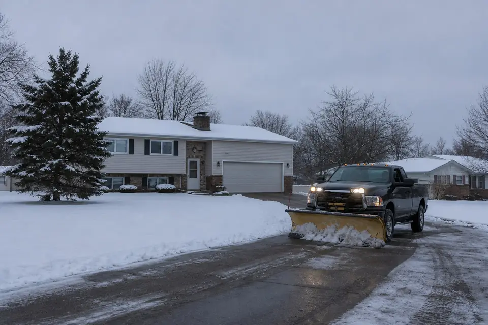
We plow first, clear walks with blowers second, and salt last. During big storms we plow overnight and early in the morning, so driveways and lots are open before people leave for work. Doing it in that order means salt goes on clean pavement, where a little works, instead of on top of snow.
- Plow the driveway or lot. Snow gets pushed to the pile spots agreed on before the season, away from beds and the street.
- Blow off the walks, steps and entrances. Our crews clear sidewalks with blowers, right down to the concrete.
- Salt where ice is left. We salt or de-ice the driveway and walks after they're cleared, not before.
Homeowners pick per-push or seasonal plans. Per-push means you pay each time we plow. Seasonal means one price for the winter, however many storms come. Our residential snow plowing page explains how each plan works.
When should you line up a plow service for the season?
Book in October or early November, before the first measurable snow. NOAA records point to a typical first snow around November 7, and our own data shows snow removal searches in the Valley peak in January. Plow routes fill as the season goes on, so waiting for the first big storm is the hard way to find a spot.
This guide grows through the winter. Over the coming weeks we'll add posts on driveway markers, salting before a storm, sidewalk rules and protecting shrubs, and each one will link back here. The Youngstown snowfall numbers get a refresh in January, once this season's totals start coming in.
Booking early also gives you a walk-through on dry ground. That's when you can point out the low curb, the drain and where the pile should go. It's much harder to explain any of that in the dark under a foot of snow.
We plow driveways and lots across Trumbull and Mahoning County, from Warren and Niles to Boardman and Canfield. If you're in the city, our Youngstown snow removal and lawn care page covers the neighborhoods we serve. To get on the route, call or text (330) 353-9809 or request a free snow plowing quote.
Frequently Asked Questions
How much snow does Youngstown get a year?
Youngstown-Warren Regional Airport averages 67.8 inches of snow a season, based on NOAA's 1991 to 2020 climate normals. January is the snowiest month at 19.6 inches, followed by February at 15.1 and December at 14.8. Totals swing a lot from year to year, and some winters come in well above or below that average.
What is the snowiest month in Youngstown, Ohio?
January. NOAA's 1991 to 2020 normals put January snowfall at 19.6 inches at Youngstown-Warren Regional Airport. Our count of NOAA daily records also shows January averaging about 19 days with at least an inch of snow on the ground, the most of any month. February is a close second on both measures.
When does it usually first snow in Youngstown?
In our count of NOAA daily records from 27 complete winters between 1990 and 2020, the median first measurable snow at Youngstown-Warren Regional Airport fell on November 7. The earliest first snow in that span came on October 2. Getting driveway stakes in and a plow service lined up by late October puts you ahead of it.
Does Youngstown get lake effect snow?
Sometimes, but the heaviest lake effect bands usually set up north of the Valley. During the Thanksgiving 2024 lake effect storm, NWS Cleveland listed 30 to 40 inch totals in parts of Ashtabula County, while spotters in Cortland, Austintown and Canfield reported under 3 inches. Most Valley snow comes from regular winter storms.
How deep does the snow get in Youngstown?
In our count of NOAA daily records from 27 complete winters between 1990 and 2020, the deepest snow on the ground each winter at Youngstown-Warren Regional Airport had a median of 9 inches. The deepest in that span was 18 inches on January 15, 1999. Plow banks along a driveway get much taller than level snow, so mark edges with tall stakes.
When should I book snow plowing in Warren?
October or early November is the best time. The first measurable snow typically lands around November 7, and plow routes fill quickly once winter starts. Booking early also lets the crew see your driveway on dry ground, mark curbs and drains, and agree on where snow gets piled before the first storm.
Get Your Free Quote
Call or send the form with your address and the work you need. We look at the property and give you a clear price before any work starts.
- Free quotes, no pressure
- Locally owned in Warren since 2012
- Insured for landscaping and snow work
- Lawn, landscaping and snow from one crew
- Trumbull and Mahoning County